AOMORI
Aomori is the northernmost prefecture in Honshu and full of nature. It’s one of the snowiest areas in Japan and has distinct beautiful sceneries. Different sights can be enjoyed in each season such as cherry blossoms in Hirosaki, the Nebuta Festival in Aomori, the autumn leaves at Oirase Mountain Stream, and the snow rime at Mt. Hakkodasan.自然豊かな本州最北の地。日本有数の豪雪地帯で独特の美しい景色や文化が魅力。弘前のさくら、青森のねぶた、奥入瀬渓流の紅葉、八甲田山の樹氷と四季折々の楽しみがある。
-
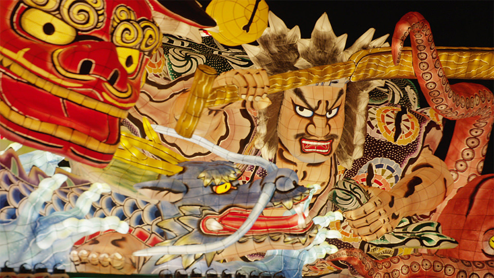
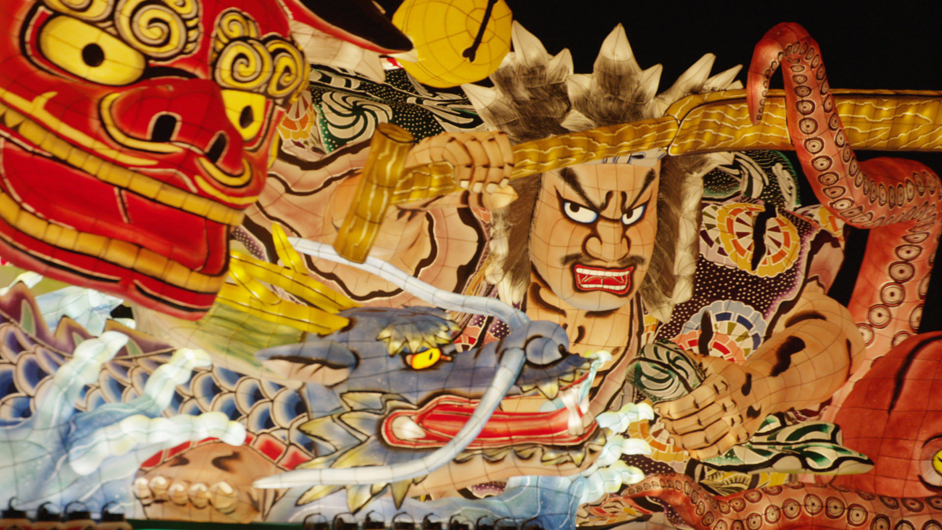
1. Nebuta Festival ねぶた祭り
One of Tohoku’s 3 biggest festivals,Giant floats of the Monkey King, Onmyoji, and demons march through the streets emitting colorful lights. The energetic shouts of the jumping “Haneto” dancers rouse everyone’s spirits.
東北三大夏祭りの1つ。孫悟空や陰陽師、鬼神などの巨大なねぶたが極採色の光を放ちながら練り歩く。飛び跳ねながら踊るハネトたちの威勢の良い掛け声が祭りを盛り上げていく。
Google Map -
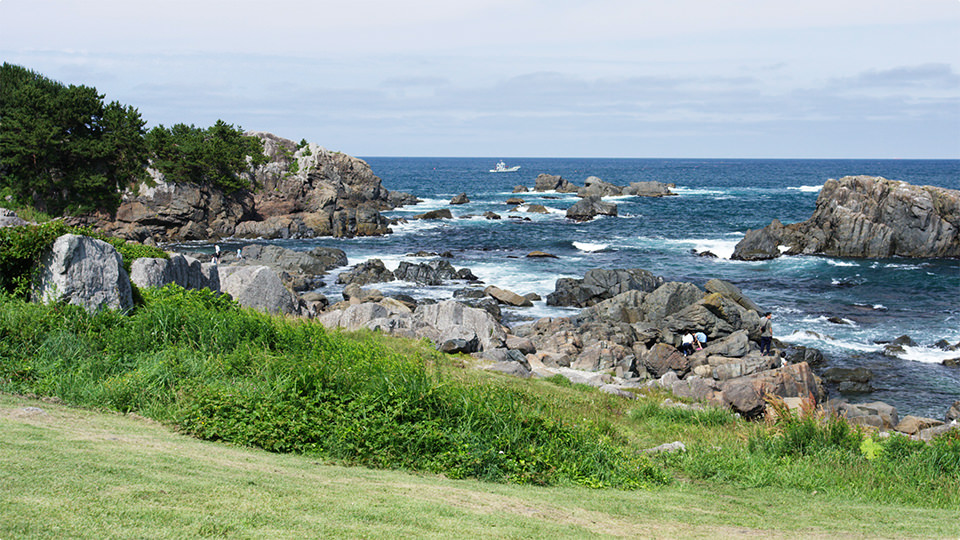
2. Tanesashi Coast 種差海岸
This coastal region extends for around 12km across the southeastern part of the prefecture. Take a stroll here and enjoy the varied scenery: natural bright green grass growing as high as the waves, giant white rocks carved by the sea, the dance of black-tailed gulls, and one of the best sandy beaches in Tohoku.
県南西部に約12㎞続く海岸地帯。波打ち際まで茂る若草色の天然芝生、荒波が作りだした白岩などの巨岩、ウミネコの乱舞、東北屈指の砂浜など、歩を進めるたび変わる景色を楽しめる。
Google Map -
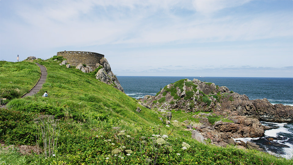
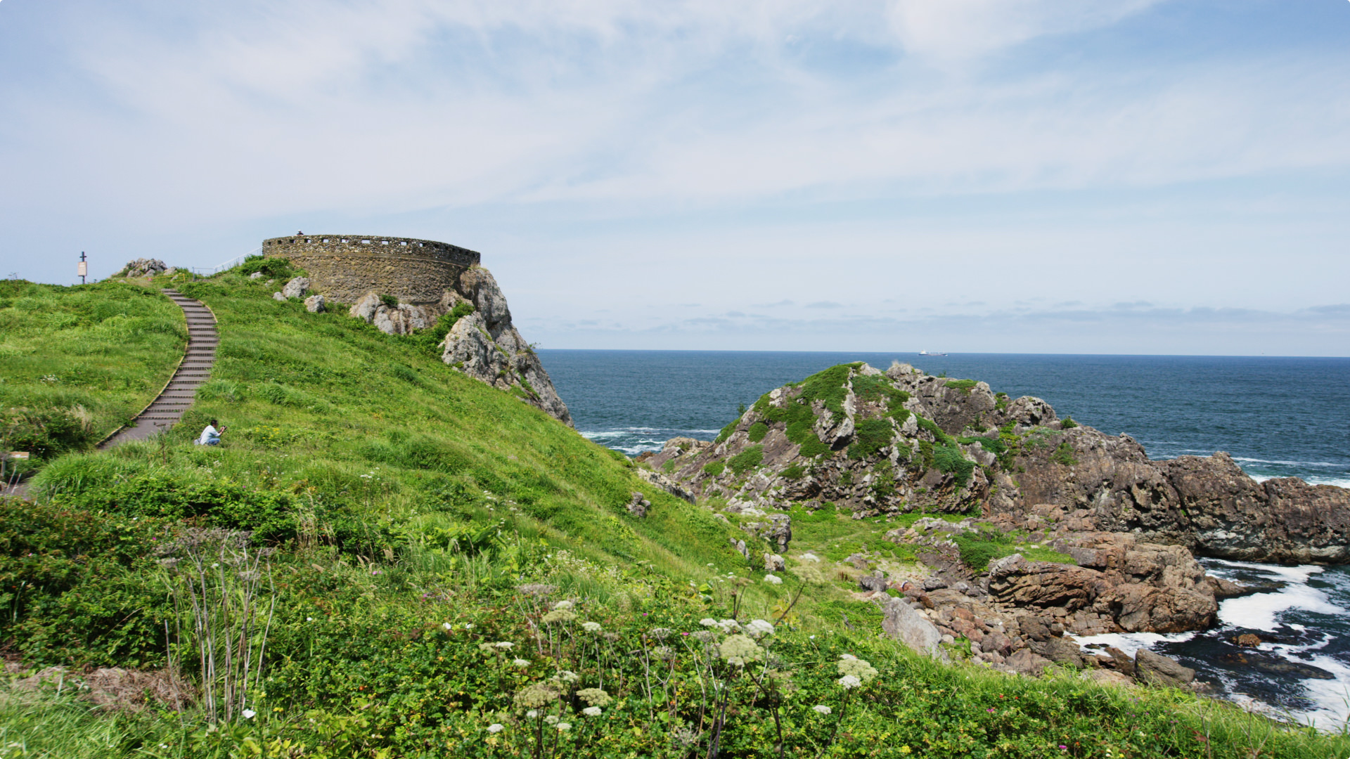
3. Ashigezaki Lookout 葦毛崎展望台
See the vestiges of the end of the Edo Period from this fort-like lookout. Built like a walkway going out to the Pacific Ocean, it offers views of the far-off horizon along with white-crested waves and a salty breeze. The footpath blooming with primeval flowers is also popular.
幕末の名残がみえる要塞のような展望台。太平洋に向かって突き出たように建ち、白波や潮風を感じながら遥か彼方の地平線まで一望できる。原生の花々が咲き乱れる遊歩道も人気。
Google Map -

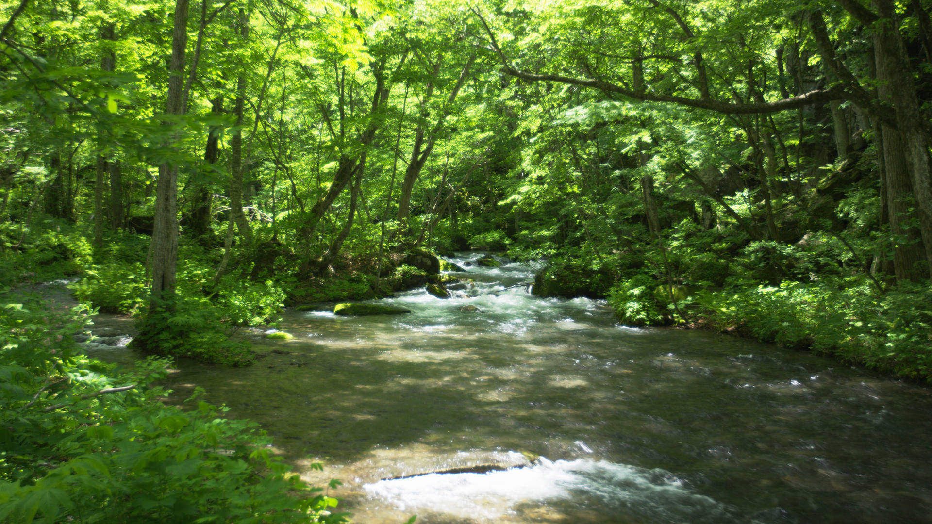
4. Oirase Stream 奥入瀬渓流
This stream in a deep natural forest is about 14km long. Walk along the tree-lined footpath to see the breathtaking scenery of the stream flowing smoothly like a watercolor painting, with moss-covered trees and rocks and majestic waterfalls.
深い自然林の渓流が約14㎞続く。木々に包まれた遊歩道を進むと、水墨画のように滑らかに流れる川や、苔むした木々や岩、雄々しく流れ落ちる滝など息をのむような風景に出会うだろう。
Google Map -

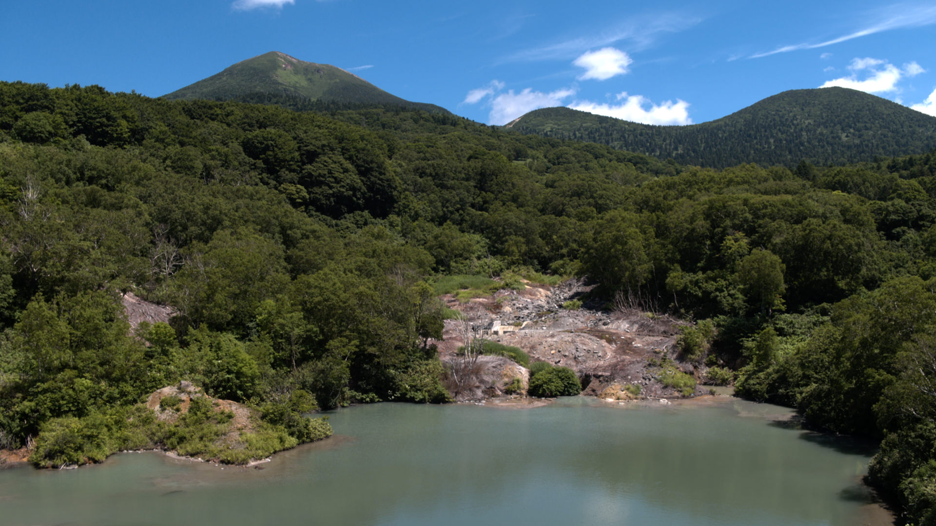
5. Jigoku-numa Pond 地獄沼
This crater pond was formed by violent volcanic eruptions. Its continuously gushing hot springs reach 98 degrees celsins at their hottest. The scene of thick clouds of steam rising in front of the Hakkoda Mountains looks just like the a hellish cauldron.
火山の激烈な噴火によってできた火口沼。湧き続ける温泉は、一番熱い所だと98度の高温に。火山郡である八甲田山を背にもうもうと湯気が立ちのぼり、まるで地獄の釜のようだ。
Google Map -

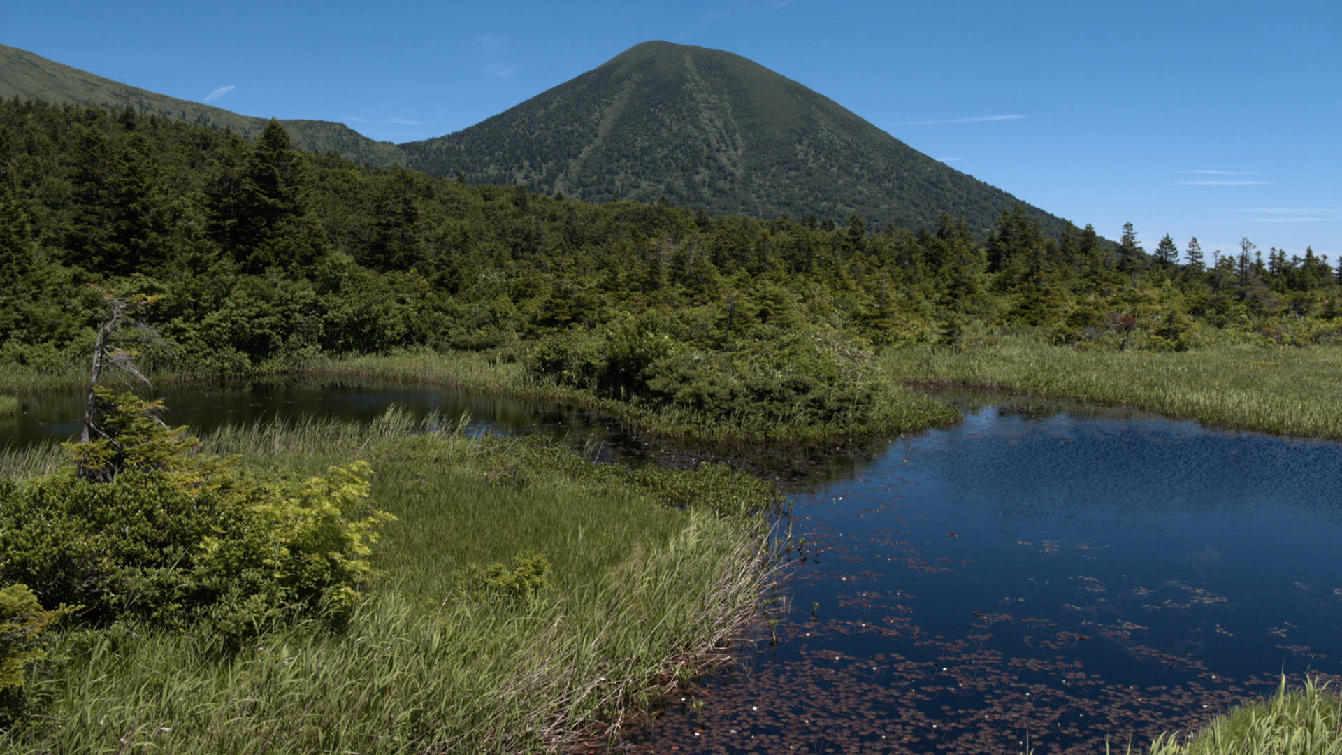
6. Suiren-numa Pond 睡蓮沼
Various marshes are scattered to the south of the Hakkoda Mountains. The mountain range is reflected on the lake surface on clear days, creating a whimsical atmosphere. This is also the perfect time to see little white lily flowers floating on the water. Sit on a lakeside bench to take it all in.
八甲田山の南に点在する沼郡。快晴の日は八甲田連邦が湖面に映り込み幻想的な雰囲気。白く小さな花を水面から浮ばせる睡蓮も見頃を迎える。ほとりのベンチに座って見とれたい。
Google Map